
Into the Enchanted Mountains: Serranía de Cuenca Road Trip
Four unhurried days from Cuenca into the Serranía de Cuenca and back: a rock city, a cliff-ringed lagoon, river springs and a gorge full of lime trees.
- StartCuenca
- EndCuenca
- Duration4 driving days, 4 nights
- Total distanceAbout 240 km
- NightsCuenca ×1 · Uña ×1 · Tragacete ×1 · Cuenca ×1
- Best forCar or motorbike
- DifficultyEasy — short legs on quiet, winding mountain roads
- Best seasonLate spring (May–June) and early autumn (mid-September–October)
- PaceRelaxed
- Flying in?Madrid (MAD) in and out; Valencia (VLC) also works. If you fly, allow an extra arrival day and departure day on top of the four driving days.
Why this Route?
Most people who reach Cuenca photograph the hanging houses and drive on. They miss what starts just north of the city. One mountain road climbs out of town along the Júcar gorge into the Serranía de Cuenca, a range of pale limestone and pine. Here water has cut rock into towers, arches and narrow lanes. This trip follows that road for four days and never drives the same stretch twice. There is no coast and no airport up here, so the crowds stay down in the city. By mid-morning at the rock city, the coaches arrive; by then you have already walked it.
Karst country, one day at a time
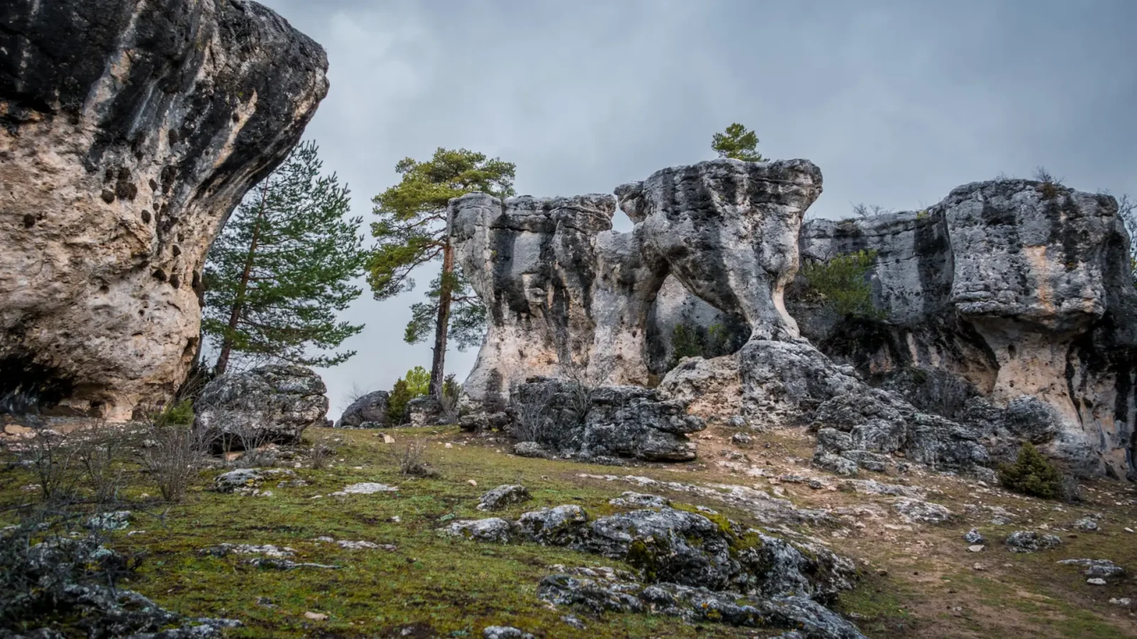
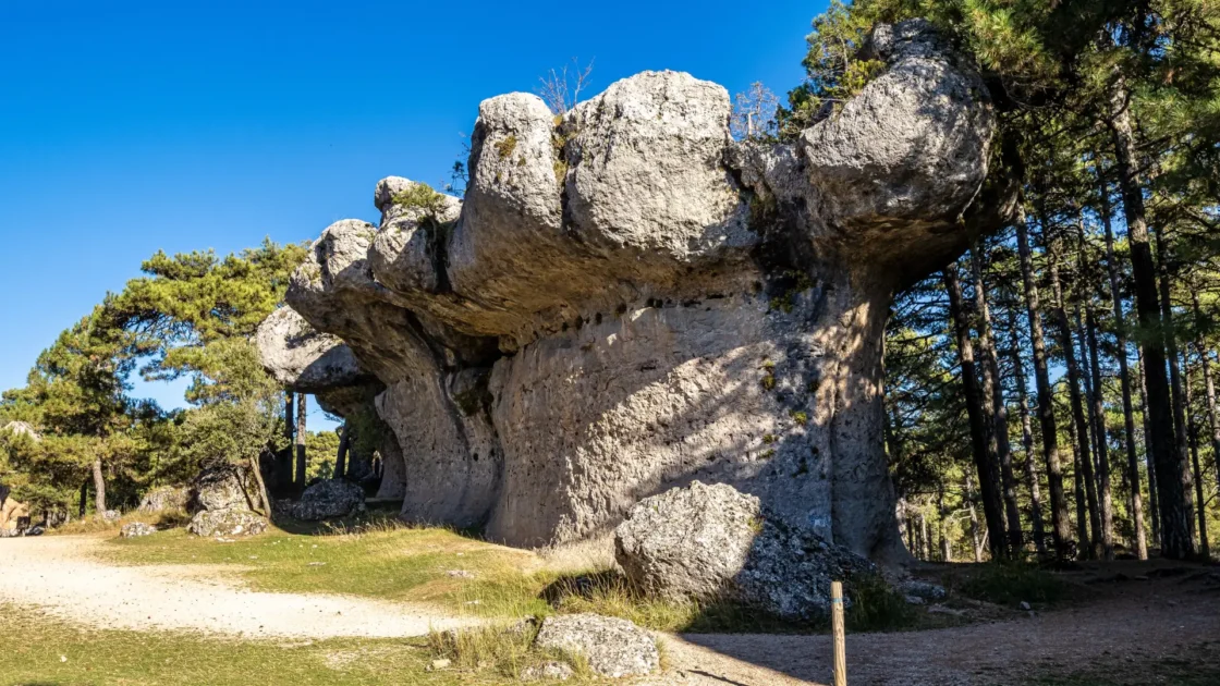
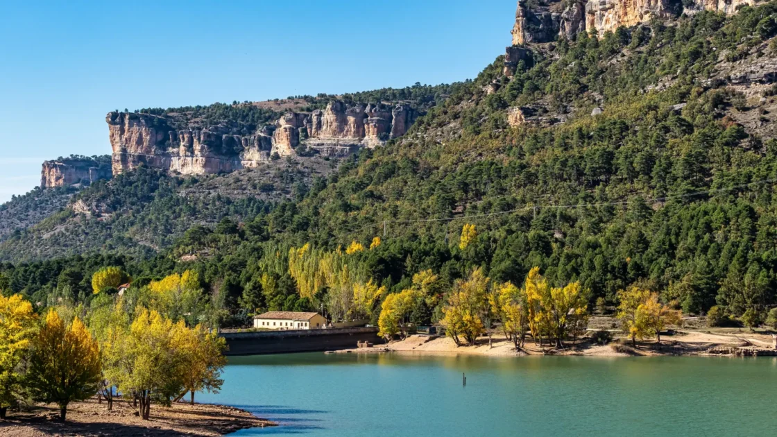
What ties the four days together is water working on stone. On the first morning in the hills you walk through the Ciudad Encantada, where a 20-metre column of rock balances on a thin neck. That afternoon you sleep beside a lagoon at the foot of grey cliffs in Uña. Next day a clifftop trail puts griffon vultures at eye level, and a forest path leads to a 30-metre waterfall on the young Júcar. On the last day the River Cuervo pours out of a mossy cave mouth. Then the road drops between the 80-metre walls of the Hoz de Beteta, under old lime trees.
How it's paced, and who it's for
This is a relaxed plan, not a checklist. The longest drive, on the last day, is about two hours at the wheel, spread across a whole day with long stops. The other days are short hops: half an hour on Day 3, and about 70 km of mountain road in small pieces on Day 2. It suits people who like a morning walk, a long country lunch and an early night in a quiet village. The trip is the drive from Cuenca into the mountains and back. It reads the same whether you fly into Madrid and pick up a car or bike, or drive down from home and start straight in Cuenca. Cuenca bookends the trip, so you get the old town twice: once on arrival, and again on the last evening.
Getting there and around
The trip begins and ends in Cuenca. There are two ways to get there: fly into Madrid or Valencia and pick up a car or motorbike, or drive down from home and start straight in Cuenca.
Flying in
- Madrid–Barajas (MAD)The most flights and the usual choice. It is about 170 km to Cuenca: roughly 1 hour 35 minutes on the R-3 toll motorway, or 1 hour 45 to 1 hour 50 on the toll-free A-3 and A-40.
- Valencia (VLC)About 193 km, roughly 2 hours 5 minutes. Handy if you want to add the coast.
- By trainCuenca’s Fernando Zóbel station is on the Madrid–Valencia high-speed line, about an hour from either city. It sits a few kilometres outside the old town, so hire your car in Cuenca if you come this way.
Flying adds a travel day at each end on top of the four driving days.
If your flight lands lateDon’t drive an unfamiliar road tired and in the dark. Sleep near the airport that first night and drive to Cuenca after breakfast. Check your hire desk’s hours before you book a late flight. Many run to around midnight, but not all, and “24-hour” pickup is not always reliable out of season. See our Practical Info page for driving-in-Spain details.
Self-drive — car or motorbikeHire at your arrival airport and keep the vehicle until you fly home. There is no useful public transport into the sierra. Most travellers hire a car, but these quiet, curving mountain roads also make this a good touring-motorbike trip.
If you’re arriving in your own car or motorbikePlenty of travellers drive down from the Netherlands, Belgium, France, United Kingdom or Germany, already have a place in Spain, or roll in from another trip. You skip the airport and the hire desk: the trip simply begins in Cuenca.
See the drive to the startOpen in Google Maps. This shows the route to Cuenca. Set your starting point in the “from” field — your home if you’re driving down, or your arrival airport if you’re flying in — then send it to your phone or car if you want it ready for the road.
The Itinerary
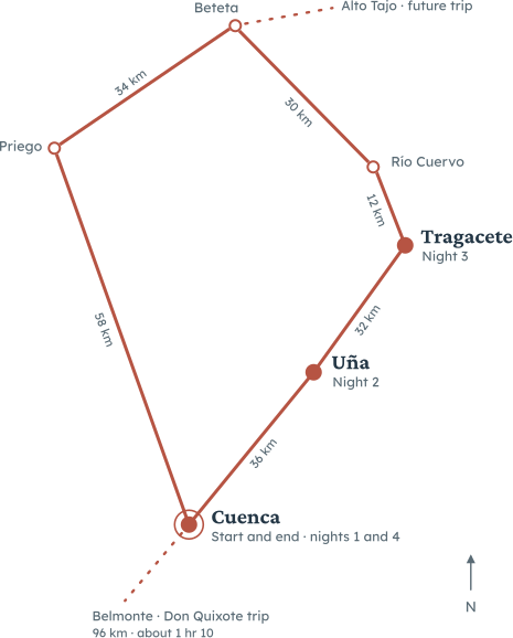
Four days, one loop. You go up the Júcar valley to Uña and Tragacete, then west past the Río Cuervo and the Hoz de Beteta, and home to Cuenca through the Estrecho de Priego. No stretch of road is driven twice. The plan below is the backbone, not the full list: each day links to that town’s own guide, so head there for every sight, restaurant and guided tour once you know which day is yours.
Day 1 — Cuenca
The driveIf you’re flying in, Madrid–Barajas to Cuenca is about 170 km, roughly 1 hour 45 minutes on the toll-free A-3 and A-40. Arriving in your own car, or from an earlier stop, you just reach Cuenca when you do; see Getting there for the ways in.
The shape of the dayAn arrival afternoon and a long evening in a UNESCO city, timed for after the day-trippers leave.
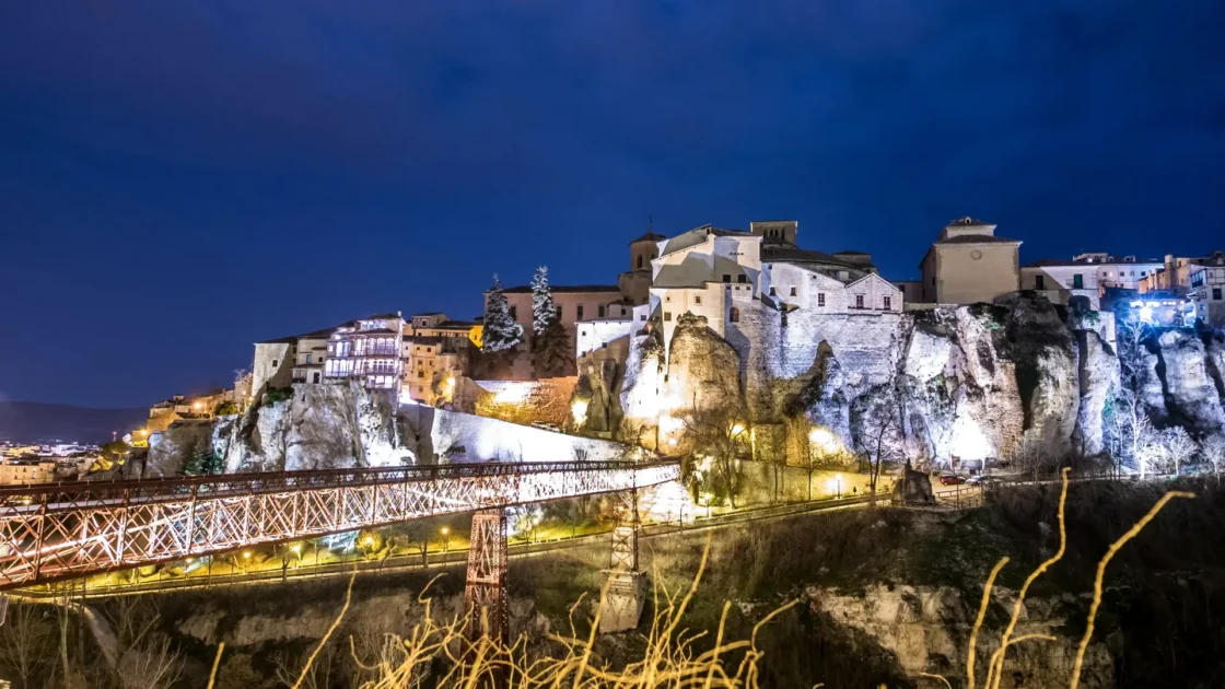
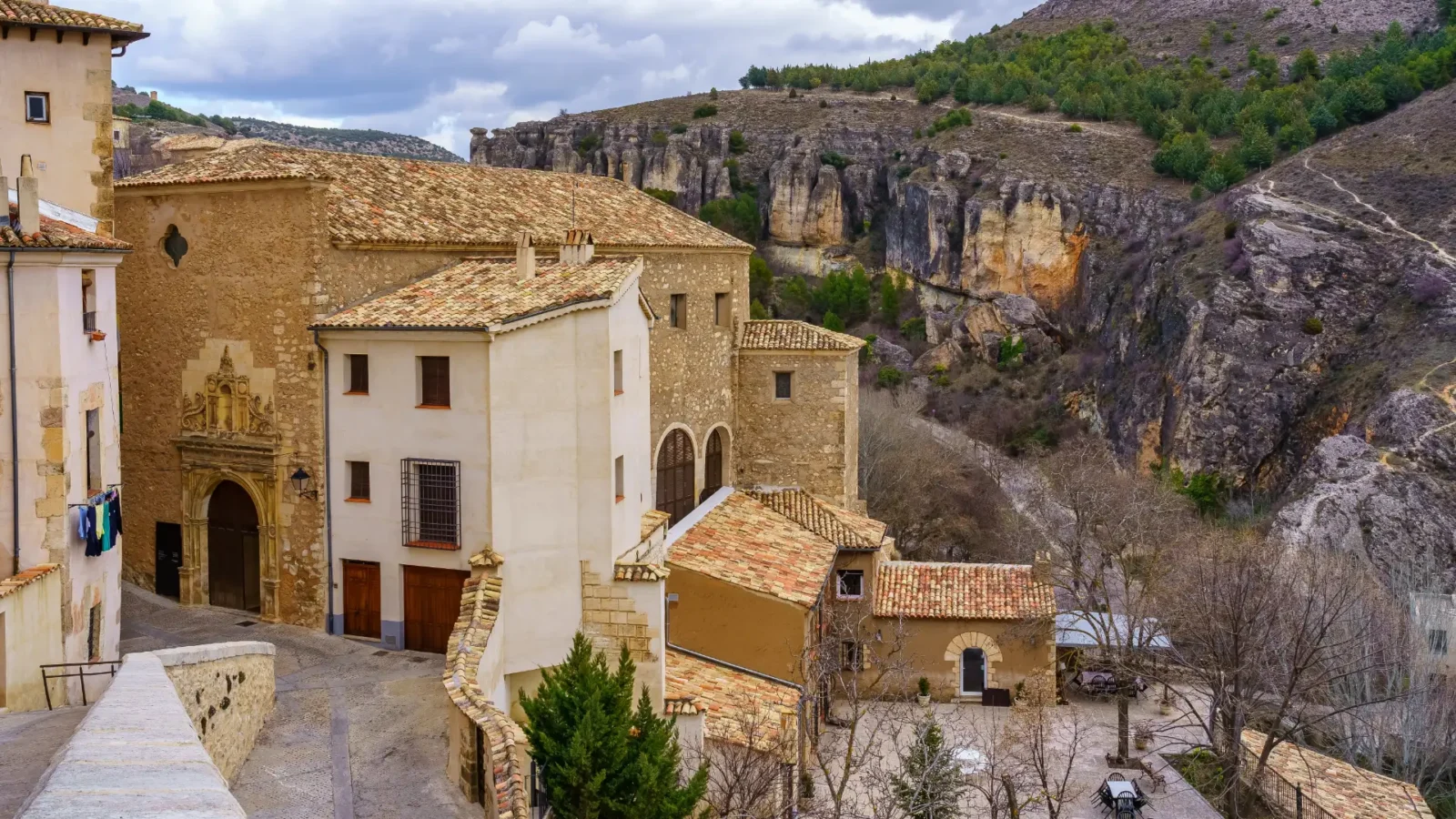
Cuenca sits on a narrow ridge of rock between two river gorges. Leave the car in the Parador’s garage or below the old town, and walk. Start on the Puente de San Pablo, the iron footbridge about 40 metres above the Huécar. It moves a little under your feet. From the middle you see the hanging houses, their wooden balconies out over the drop. The largest of them holds the Museo de Arte Abstracto Español, a free museum of Spanish abstract art. It is closed on Mondays and on Sunday afternoons, so check ahead. Then climb to the Plaza Mayor, where the town hall arches over the road. The cathedral stands at the top of the square, with its blunt, unfinished front. It was begun around 1196 and is among the first Gothic cathedrals in Spain. A combined ticket lets you climb to the triforium, high above the nave. Allow a relaxed half-day. After dinner, walk back over the bridge in the dark, when the gorge and the houses are lit.
Want a different pace?Pick at most one; it’s still one day, and you still sleep in Cuenca. Slow it down: skip the museum and the cathedral, sit in the Parador’s courtyard, and cross the bridge only at dusk. Or add an easy walk: drop down to the river path in the Hoz del Huécar and look up at the houses from below.
Where to eatCuenca’s dishes are morteruelo, a warm, spiced pâté of game, and zarajos, lamb offal wound round a vine shoot and grilled.
- Lunch tipCuatro Sabores (€€ · Conquense · Cuenca). A small lower-town kitchen that cooks the food of the province: duck ham on salad, cannelloni filled with local meat, grilled skewers and zarajos. If you land early, this is where you eat on arrival; on a midday landing, start with dinner instead. Closed Mondays; on a Monday, La Ponderosa (€€€ · Tavern · Cuenca) a few doors along is open for lunch, a standing-room bar famous for its ham and seasonal mushrooms (it closes at weekends).
- Dinner tipEl Torreón (€€ · Tapas and grill · Cuenca). Up in the old town on Calle Larga, with aged steaks, crisp torreznos, zarajos and one of the longest Spanish wine lists in the city. Open daily; book at weekends, as it fills.
Where you sleep tonightTonight you sleep in Cuenca, at the Parador across the gorge from the hanging houses. You come back here for the last night too. See where we’d stay.
Day 2 — Uña
The driveCuenca to Uña is 36 km direct, about 35–40 minutes. Today’s route adds up to about 70 km, all in short stretches: past the Ventano del Diablo, up to the Ciudad Encantada, down to Valdecabras for lunch, then over the top to Uña.
The shape of the dayA rock-city morning, a long village lunch, and a lakeside evening.
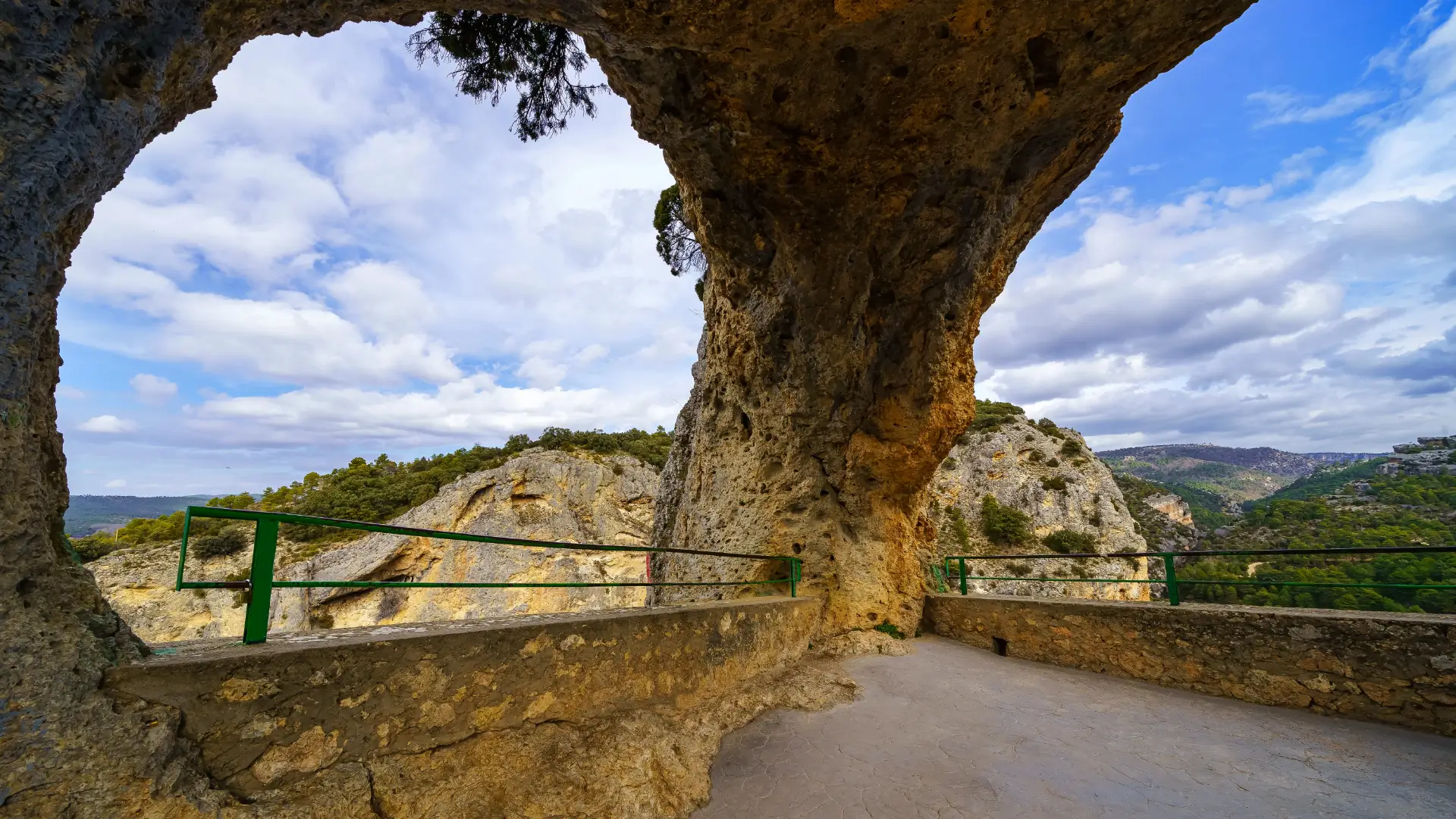
Leave Cuenca by half past nine on the CM-2105, which follows the Júcar gorge north. About two kilometres past Villalba de la Sierra, pull in for the Ventano del Diablo, the “Devil’s Window”. A short railed path leads to a hole in the cliff that frames a long drop to the river. Ten minutes is enough. Three kilometres on, turn up the CM-2104 to the Ciudad Encantada. It opens daily at 10:00, and closing time changes with the season. Tickets are sold only at the gate, and card machines can fail up here, so carry cash. A signposted circuit of about three kilometres winds through the rocks in around an hour and a half, over almost flat ground. You pass the Tormo Alto, a 20-metre mushroom of stone on a thin stem. Arrive at opening time, and on a weekday if you can. Afterwards, drive ten minutes down the far side of the hill to Valdecabras for lunch. Then head back over the top and down to Uña, about half an hour away. In the late afternoon, walk the flat path around the Laguna de Uña. It is about three kilometres, below grey cliffs, and takes under an hour.
Want a different pace?Pick at most one; your base is unchanged. Slow it down: skip the Valdecabras detour, drive straight to Uña after the rock city, and have a long lunch and a lazy afternoon by the water.
Where to eatUp in the sierra the plate turns to game and river fish: venison stew, trout and slow-cooked lamb.
- Lunch tipRincón de Valdecabras (€€ · Home cooking · Valdecabras). A small restaurant in a tiny village, about ten minutes below the Ciudad Encantada. The menu marks what is made in the kitchen, and regulars come back for the beans with partridge. Lunch only; closed Mondays and Tuesdays; book ahead. On a Monday or Tuesday, eat at Nelia (€€ · Traditional · Villalba de la Sierra) instead, beside the road at Villalba, known for its cod; it closes on Wednesdays.
- Dinner tipAgua-Riscas (€€ · Castilian · Uña) The restaurant of the Hotel Uña, with a fire lit on cold nights and a terrace facing the lagoon. Order the venison stew. Open daily.
Where you sleep tonightTonight you sleep in Uña, at the hotel by the lagoon, a few steps from tomorrow’s trailhead. See where we’d stay.
Day 3 — Tragacete
The driveUña to Tragacete is about 32 km, roughly 30 minutes, up the Júcar past the Embalse de la Toba reservoir and the village of Huélamo.
The shape of the dayA clifftop morning above Uña, a short drive, and a waterfall walk in the high sierra.
Start early on the Escalerón and La Raya trail, which climbs from the village onto the cliffs above the lagoon. It is a loop of about nine to ten kilometres. Some steep sections use wooden stairways and walkways fixed to the rock. Allow a half-day, and skip it if heights unsettle you. From the top you look straight down on the lagoon and the roofs of Uña. Griffon vultures often ride the air level with the path. There is no shade up there, so carry water. After lunch in Uña, drive on to Tragacete, one of the highest villages in the region at about 1,281 metres. Late in the afternoon, walk to the Chorrera del Molino. Cross the small bridge over the Júcar and follow the track towards the San Blas refuge. Then take the signed botanical path down to the river, about two kilometres each way. The last stretch is a boardwalk to a waterfall of around 30 metres. It runs fullest after rain or snowmelt and can thin to a trickle in a dry late summer. The park’s interpretation centre in the village opens mainly at weekends and in high season.
Want a different pace?Pick at most one; you still sleep in Tragacete. Slow it down: skip the clifftop trail, walk the lagoon loop at first light instead, and reach Tragacete for a long lunch. Or add a little more: from the Chorrera del Molino, carry on past the San Blas refuge to the source of the Júcar itself, a longer and rougher walk that few people make.
Where to eatTragacete’s kitchens cook game you rarely see on the plains, venison and fallow deer (gamo), and zarajos turn up here too.
- Lunch tipZaballos (€€ · Grill · Uña). A village bar-restaurant known locally for meat from the grill, with big portions after a morning on the cliffs. Closed Wednesdays; La Laguna (€€ · Home cooking · Uña) across the lane does a good-value set lunch by the water (it closes on Mondays).
- Dinner tipRestaurante Serranía (€€ · Mountain cooking · Tragacete), at the hostal where you sleep. The kitchen cooks the sierra’s dishes: morteruelo, ajoarriero, trout, lamb stew and game. It gives priority to hotel guests, so book your table when you check in. If it is shut, Mesón El Vasallo (€€ · Village bar · Tragacete) on the main square does zarajos, ajoarriero and wild-boar meatballs (closed Wednesdays and Thursdays).
Where you sleep tonightTonight you sleep in Tragacete, at the family-run hostal in the village, with the Río Cuervo a short drive up the road for the morning. See where we’d stay.
Day 4 — Río Cuervo, Beteta, Priego and back to Cuenca
The driveTragacete to the Río Cuervo is about 12 km, 10–15 minutes. Then about 30 km, half an hour, north to Beteta. Beteta to Priego is about 34 km, 35 minutes, through the Hoz de Beteta and the Estrecho de Priego. Priego to Cuenca is 58 km, just under an hour. That is about 134 km and 2 hours 10 minutes at the wheel, spread across the day, and none of it on a road you have already driven.
The shape of the dayA spring at breakfast time, a gorge at midday, and Cuenca again by late afternoon.
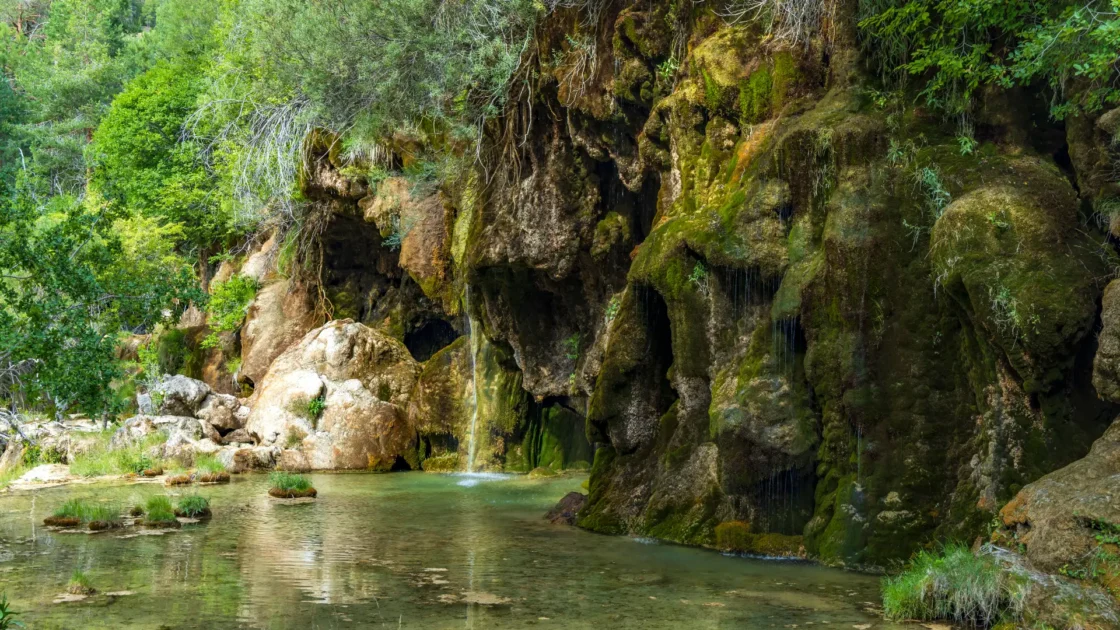
Be at the Nacimiento del Río Cuervo early, before the weekend crowds. Entry and parking are free, and it is open all year. An easy loop of about an hour climbs past small falls where the water slides over moss-covered rock. At the top, the river comes out of a narrow cave mouth. The falls are fullest in spring and after autumn rain; in a dry late summer they can run very low, and in hard winter they freeze.
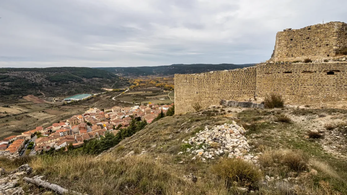
Then drive north through Masegosa towards Beteta. On the road in, a signed turn-off climbs to the Castillo de Rochafrida, a ruined fortress at about 1,300 metres on a rock above the village. Its five-sided keep is rare in the region. From the viewpoint beside it, next to a stone statue of Christ, you look down the Guadiela valley into the mouth of the gorge. Entry is free, and a car park sits close to the walls; half an hour is enough. Then drop into the Hoz de Beteta, where the road runs beside the Guadiela between limestone walls more than 80 metres high. Park at the Fuente de los Tilos picnic area and walk the botanical path through old lime trees to the foot of the cliffs, about 25 minutes. From March to October you can finish with a guided visit to the Cueva de la Ramera. You climb a 20-metre metal stairway, then spend about 45 minutes inside with a guide in a small group. It is closed in winter, when bats hibernate there, so check times with the Beteta tourist office. Near Beteta, the Sumidero de Mata Asnos is a swallow-hole where a stream sinks into the ground. After Cañamares, the CM-2023 enters the Estrecho de Priego. Here the River Escabas cuts through the last ridge of the sierra, and vultures circle above the narrows. Have lunch in Priego, then drive the last hour back to Cuenca for a final evening in the old town.
Want a different pace?Pick at most one; you still sleep in Cuenca. Slow it down: skip the cave and the walk, drive the CM-210 slowly with stops at the pull-outs, and reach Cuenca early. You then have time for the abstract art museum if you missed it on Day 1.
Where to eatBack in Cuenca tonight, it is your last chance for morteruelo or zarajos.
- Lunch tipLos Claveles (€ · Set menu · Priego). A hostal restaurant with a big dining room and cloth tablecloths, serving a generous, good-value set lunch to locals and passing riders. Lunch only; closed Thursdays. On a Thursday, San Nicolás de Bari (€€ · Tapas · Priego) is across the street (it closes on Tuesdays).
- Dinner tipRaff San Pedro (€€€ · Modern Spanish · Cuenca). A special last dinner, two floors down in the cellars of an old-town house, with a tasting menu, homemade bread and wine pairings. Closed Tuesdays; on a Tuesday, go back to El Torreón (€€ · Tapas and grill · Cuenca). Open daily.
Where you sleep tonightTonight you sleep in Cuenca, at the Parador across the gorge from the hanging houses. You come back here for the last night too. See where we’d stay.
Practical Info
- RoadsOnce you leave the motorway, these are quiet regional roads (CM-2105, CM-2104, CM-2106, CM-210, CM-2023). They are well surfaced but winding, with drops and few barriers, so drive them in daylight. There are no tolls in the sierra. From Madrid, the R-3 is a toll motorway; the A-3 and A-40 are the free alternative.
- FuelFill up in Cuenca before you head north. There are small filling stations in Tragacete and Beteta, but their hours are short.
- Parking in CuencaDon’t drive into the upper old town; the lanes are tight and partly restricted. Use the Parador’s garage or the car parks in the lower town, and walk up.
- CashThe Ciudad Encantada sells tickets only at the gate, and card machines can fail with the patchy mountain signal. Small village bars can be cash-first too.
- Electric vehiclesCuenca has plenty of public charging points, and the Parador has one of its own. In the sierra we could not confirm reliable public chargers, so treat Cuenca as your charging base. Days 2 to 4 add up to about 240 km, which most modern electric cars can cover from a full charge in Cuenca. Plan the mountain days with a charging app rather than hoping for a charger in a village.
- Altitude and weatherCuenca sits at about 950 m and Tragacete at about 1,281 m, so the sierra is much cooler than the plains. Tragacete’s yearly average is about 9.5 °C. Pack a warm layer even in July. Winters bring snow and ice, and some trails get slippery.
- Water and seasonsThe Río Cuervo and Chorrera del Molino falls are fed by rain and snowmelt. They run fullest in late spring and after autumn rain, and can run very low in a dry late summer.
- Seasonal closuresThe Cueva de la Ramera is open only from March to October. The Tragacete interpretation centre opens mainly at weekends and in high season.
- Country hoursLunch is the main meal up here. Small kitchens often close in the afternoon and can close early at night, so don’t leave dinner too late.
- Good to know:
- ShoesSturdy shoes for the stone paths, the boardwalks and the Escalerón stairways.
- LayersA warm layer for early mornings and evenings, in any month.
- CashCash for the Ciudad Encantada gate.
- WaterWater for the longer walks; the river water is not for drinking.
Where we’d Stay
Your four nights, in order: three places, one strong pick each, chosen so you can just book and go. Cuenca is both the first and the last night. Flying in? We’ve also added an optional airport-side stay for before the trip and before you fly home, outside the four trip nights.
Meliá Madrid Barajas
Beside Adolfo Suárez Madrid-Barajas (MAD). If you land late or fly out early, skip the drive into the city and stay by the airport instead. This comfortable 4-star sits right next to the terminals. It runs a free shuttle to T1, T2 and T4 through the small hours, so a late arrival or a dawn departure is easy. Pick up the hire car fresh the next morning, or drop it and walk to check-in the night before.
Check prices & availability for Meliá Madrid Barajas on the accommodation's websiteParador de Cuenca
Sleep inside history: this Parador fills the former Convent of San Pablo, right across the gorge from the hanging houses, reached by its own footbridge. Recently refreshed, with a quiet courtyard and rooms that look straight at the old town. The Cuenca stay if you can stretch to it.
Check prices & availability for Parador de Cuenca on the accommodation's websiteHotel Uña, Serranía Encantada
A simple, friendly village hotel right by the lagoon, steps from the Escalerón trailhead and well placed for the karst country you saw today. Its restaurant is a bonus in a village this small — handy for dinner after a day on the trails.
Check prices & availability for Hotel Uña, Serranía Encantada on the accommodation's websiteHostal Restaurante Serranía
A family-run mountain hostal in the village, popular with hikers and riders, with its own restaurant — worth knowing here, because Tragacete’s kitchens can close out of season and this one keeps you fed after a day in the high forest. A plain, warm base at ~1,281 m, a short walk from the Chorrera del Molino path and a short drive from the Río Cuervo. Book ahead in autumn (mushroom season) and on long weekends.
Check prices & availability for Hostal Restaurante Serranía on Booking.com
For the full range of places to stay in each town — every budget — see the individual town guides linked through the itinerary above.
Frequently Asked Questions
Four days is the right length for a Serranía de Cuenca road trip: one evening in Cuenca, two nights in the mountain villages of Uña and Tragacete, and a last night back in Cuenca. That covers the Ciudad Encantada, the Río Cuervo and the Hoz de Beteta without rushing. If you fly in, add a travel day at each end.
For the Serranía de Cuenca, fly into Madrid–Barajas, about 170 km from Cuenca. It has the most flights. Valencia is the other option, about 193 km away. Cuenca is also on the Madrid–Valencia high-speed rail line, about an hour from either city.
Yes, you need a car or motorbike in the Serranía de Cuenca. There is no useful public transport into the mountains, and the rock city, the springs and the gorges are all a drive apart. You don’t need it inside Cuenca’s old town; park below and walk up.
Driving in the Serranía de Cuenca is easy but slow: quiet, well-surfaced regional roads that wind through gorges and pine forest, with no tolls. The longest day is about 134 km with plenty of stops. Drive in daylight, as the roads are narrow and unlit.
The best time to visit the Serranía de Cuenca is late spring (May to June) and early autumn (mid-September to October). The Río Cuervo falls run fullest in spring. Summer is green and cooler than the plains. Winter brings snow and ice, and the Cueva de la Ramera is closed from November to February.
No, the four-day Serranía de Cuenca road trip is built to be relaxed. Once you reach Cuenca, Day 1 has no driving, Day 3 is about half an hour, and Day 2 is about 70 km in short hops. The last day is about two hours at the wheel, spread across a full day of stops. Each day leaves room for a long lunch and an early evening.
Yes, you can drive this Serranía de Cuenca trip in your own car or motorbike, not only as a fly-drive. Just start in Cuenca. To extend it, drive about an hour south-west from Cuenca to Belmonte and join our Don Quixote road trip across the plains of La Mancha.
Yes, you can do the Serranía de Cuenca road trip in an electric car with some planning. Cuenca has plenty of chargers, and the Parador has one of its own. We could not confirm reliable chargers in the mountain villages, so leave Cuenca fully charged. The mountain days add up to about 240 km.
The Río Cuervo waterfalls near Tragacete depend on the season. They are fullest in spring after the snowmelt, and again after autumn rain. In a dry late summer they can run very low, though the spring and the forest walk are still worth it. In hard winter they can freeze.
No booking is possible or needed for the Ciudad Encantada near Cuenca: tickets are sold only at the gate, so bring cash. The Cueva de la Ramera in the Hoz de Beteta is visited only with a guide, in small groups, from March to October; check the day’s times with the Beteta tourist office.
Where to Next
The loop brings you back to Cuenca, so you are well placed for three onward moves.
- Flying homeCuenca to Madrid–Barajas is about 170 km: roughly 1 hour 35 minutes on the R-3 toll motorway, or 1 hour 45 to 1 hour 50 on the free A-3 and A-40. Valencia airport is about 193 km, roughly 2 hours 5 minutes. If your flight is early, spend the last night near the airport instead of in Cuenca. It is the same four nights with a different last base, so the trip stays the same length.
- West onto the plains: the Don Quixote tripFrom Cuenca it is about 96 km, roughly 1 hour 10 minutes, south-west to Belmonte and its hilltop castle. Belmonte is a stop on Day 3 of our In the Footsteps of Don Quixote road trip, so you can drive on through the Campo de Montiel to the Lagunas de Ruidera. Or drive to Toledo and do it from the start. The change is sharp: pine and limestone one day, the open plain of La Mancha the next.
- North into the Alto Tajo (future trip)If the gorges of Day 4 leave you wanting more, the Alto Tajo continues north of Beteta. The natural place to branch off is Beteta itself, instead of looping back to Cuenca. A future Alto Tajo road trip will start from there.
- See the drive onwardThis starts from Cuenca. Set your destination in the “to” field — the fly-out airport, your next route’s first stop, or home — and send it to your phone if you want to navigate it. Open in Google Maps
Essential Reading
Regions this trip crosses
Related routes
- In the Footsteps of Don Quixote: La Mancha Road Trip
Here you find optional road-trips to extend your route.